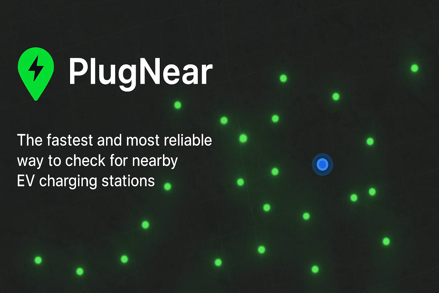
Plug Near
As electric vehicles become more common, easily finding a charging station is essential. I developed PlugNear, a full-stack web application that provides a seamless solution for EV drivers.
Hi, I'm Michael, a student at the University of Waterloo pursuing a degree in Geomatics. I have a deep passion for computer science and mathematics, which drive my interest in the dynamic fields of remote sensing and ai.
Through my studies, I am exploring how geospatial data and cutting-edge technologies intersect to solve real-world challenges. I'm particularly fascinated by how AI enhances data analysis in applications such as satellite imaging, self-driving cars, and environmental monitoring.
View ResumeAs electric vehicles become more common, easily finding a charging station is essential. I developed PlugNear, a full-stack web application that provides a seamless solution for EV drivers.
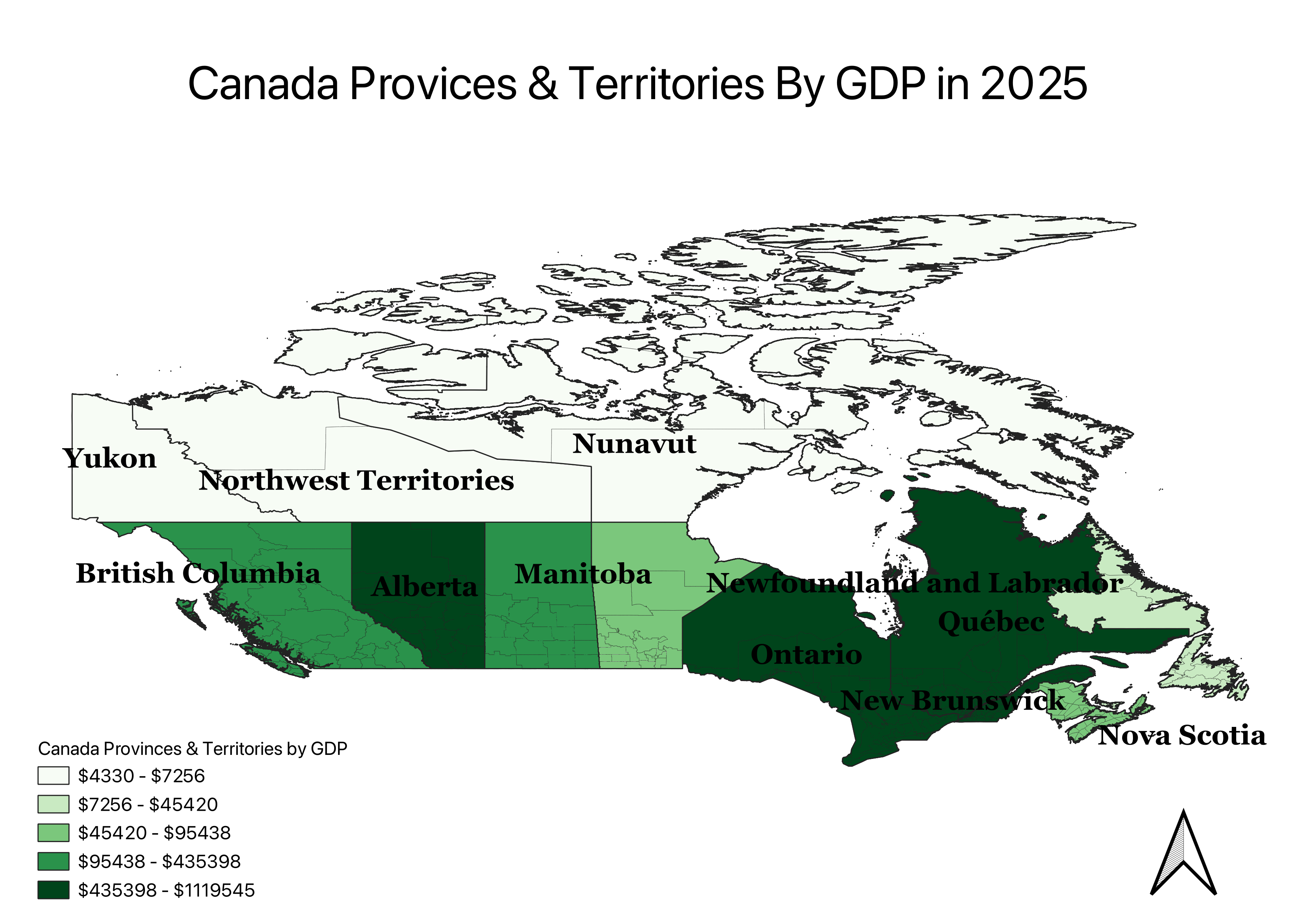
This map provides a clear visual breakdown of the projected economic output (GDP) for every Canadian province and territory in 2025. I created this visualization to make it easy to see and compare the economic strength of different regions across the country at a glance.
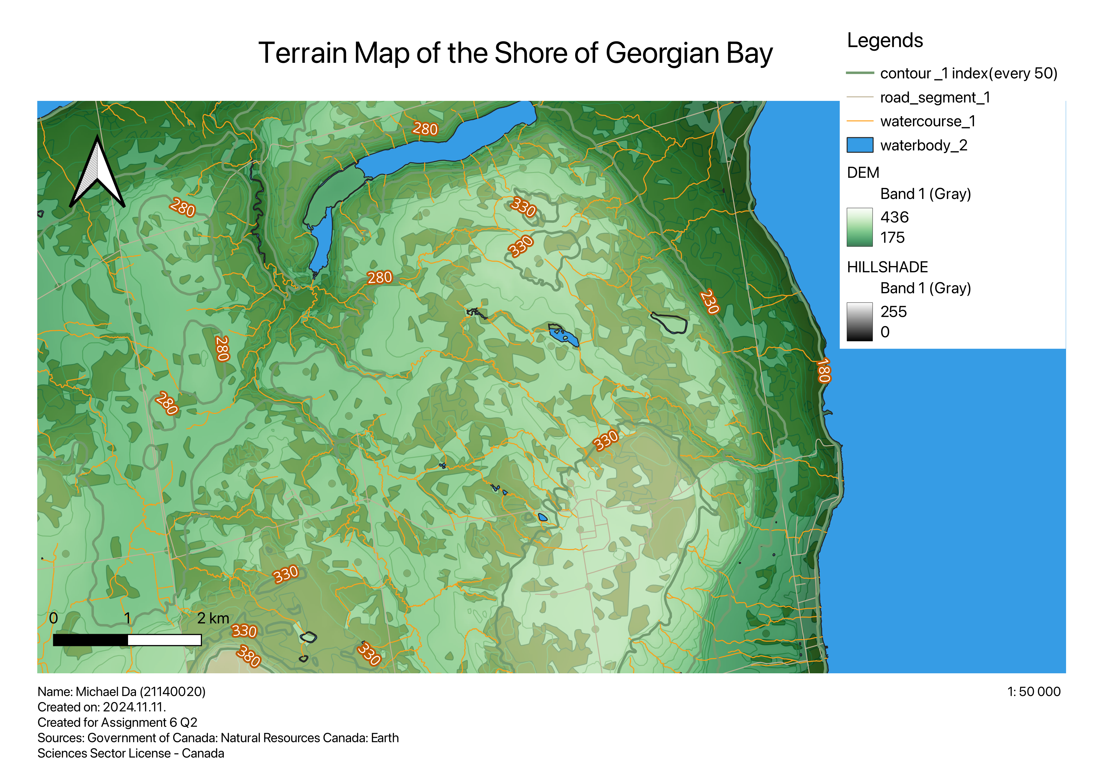
This is a terrain map of the Georgian Bay coastline, showcasing the land's elevation and features. Using shaded relief, contour lines, and different colors, the map provides a clear visual of the hilly landscape, valleys, and waterways. The map also highlights local roads and bodies of water, giving a complete picture of the geographic area for easy interpretation by any audience.
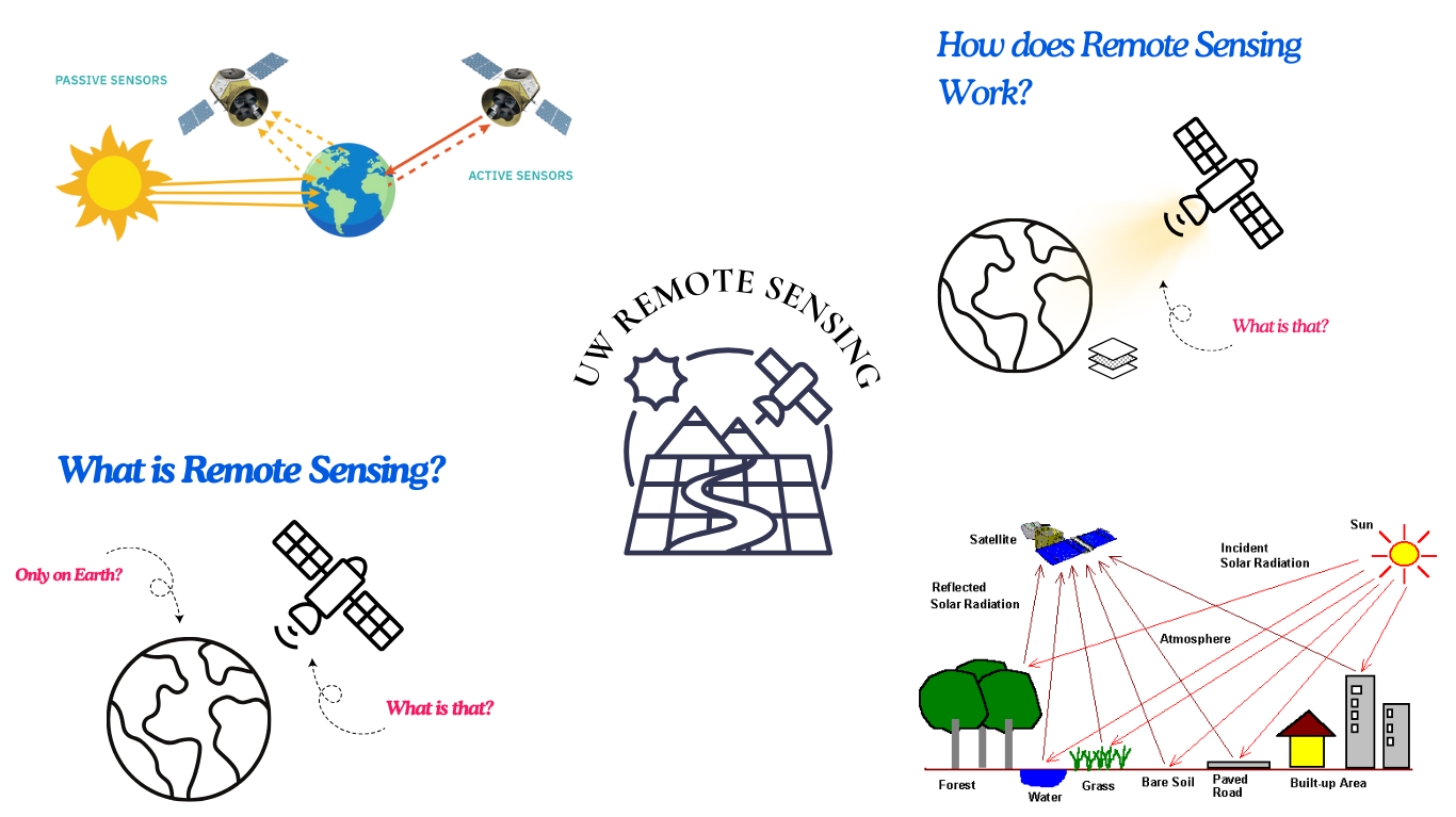
This is a outreach on remote sensing for undergrad students. This outreach has gained over 100+ followers and 3000+ impressions on Instagram.
Michael Da - mda@uwaterloo.ca
Connect with me!